MYSTERY ISLAND - real name INYEUG ISLAND - VANUATU
LAST VISITED JAN 2019
Mystery Island is most people's idea of a tropical island - it is a coral cay, an ex atoll whose central lagoon has been filled partially filled by wave/wind deposited detritus from the reef.
Mystery Island is pretty tiny - the land just to its north is a south western peninsula on a bigger island of Aneityum, which is in the far south of the Vanuatu island chain.
Note some confusion here - HOLLAND AMERICA cruise line calls the smaller island ANEITYUM and the larger one TANNA but other cruise lines and online sources differ.
RELATIVE SIZES
As said, Mystery Island (at bottom) is tiny. I'm thinking 900m/200m longest/widest.
Vanuatu is a fair bit south-east of PNG's Trobriand islands - approx 2400km. But you are still well and truly in the tropics. Aneityum is the southern-most island visible in the chain above.
I pinched this map from https://lb.wikipedia.org/wiki/Vanuatu.
MYSTERY ISLAND-VANUATU (2) relative to other places in this section - 1 KIBOLA-KIRIWANA-PNG 3 YEJELE-MARE-NEW CALEDONIA 4 NOUMEA-NEW CALEDONIA 5 ISL OF PINES-NEW CALEDONIA 6 LIFOU-NEW CALEDONIA.
Numbers may be clearer if you click-expand image.
Aneityum (at left - top image) is pretty mountainous whereas Mystery island is typical of coral cays which rarely get more than a few meters above sea level.
I reckon this is the main reason MI has no permanent settlement (the story goes it's haunted) - it would not be too great during the huge waves and tidal surges of a tropical cyclone aka hurricane/typpoon. Lack of running water is another problem. So "locals" live on the bigger island and move across to sell beers, food, touristy souvenirs, hire snorkels etc when the cruise liners arrivE. Hell, there is even a rough grass airstrip to enable access from further afield - and it's about the only flat spot around Aneityum so naturally it acts as that island's airpfield.

The general area has a pretty big surrounding reef which requires cruise liners to moore a fair way from the island, meaning tender trips are not short. However the island and the reef provides good shelter from the prevailing south east trade winds - in 4 visits we have always managed to get onto the island unlike say nearby ISLE OF PINES. However I have read that some cruise visits to MI have ended with no landing - so maybe we have been lucky.
Kinky horizon from my elcheapo camera's panorama setting which doesn't always stitch shots all that well. However they do click-expand nicely.
Um---a little better.
This shot shows more island, less surrounding reef-lagoon. I cranked in enouth telephoto to approximated view from ship (most cameras' normal settings throw to mild wide angle which makes objects appear more distant and smaller).
BEST BEACH WINDY represents most popular beach spot, but if you arrive on a blustery day you may be better off on the lee side (arrivial) of the island - the whole beach along there is SHELTERED.
People seeking an uncrowded strip of sand should head for the places marked "s" for SECLUSION.
BEST SNORKELING I've found is in the south-east bay (fortunately the offshore reef protects this from ocean swells and chop on blustery days) but I have seen people snorkeling all around the island.
Only place without sand is in the far south - here a rock platform replaces silca, but I have seen snorkelers working over the aqua here.
ANEITYUM behind VOYAGER OF THE SEAS Feb 2018;
This beach in the island's south-east is probably the best, but there are sections of sand all around the island except at the very south end. A walking track does the circuit - took me about 40 minutes.
Note weather conditions are important - I have been here in late October and November - despite being in the sub-tropics, the SE trades and sea temps during Spring are not quite warm enough to make it pleasant on this exposed side of the island on more blustery days - the western lee side is a better idea. A 2016 visit was in mid-summer February - the trades still blowing but were welcome as a cooling agent in this hotter period. Water temp very nice.
PIER SIDE
If it's windy, particularly in SPRING/AUTUMN you may prefer the arrival/lee side of the island.
The beach is okay here - maybe a bit narrow but plenty of room to lay a towel/sarong. There is limited shade in back of the beach. Maybe the biggest hassle is a band of rock on entry to the water or just offshore depending on the tide. Locals offer snorkeling gear and some neat glass-bottomed kayaks along here.
Sheltered side - pic from the pier. These people are off on some diving/snorkeling/sightseeing trip. In this 2016 pic the LEGEND is a lot further offshore than 2017 in the shot before. If the wind has some north in it (not too common but featured our Feb 2018 visit) the section of beach around that far spit is sheltered.
Since this 2016 pic was shot a new pier has been constructed.
WINDWARD SIDE
This is the opposite side - pretty nice when the wind is not too strong (or on those mid-late summer days when the sun is real hot and you welcome some cooling wind).
This is 2017 pic is shot from more or less the same spot as the 2015 one up page. Area around camera is good for people seeking low crowds, but heading away from the camera....
....you reach the MOST POPULAR beach area (doesn't seem real crowded in this shot) which is easily accessed by walking the short distance driectly across the island from the arrivals pier.
Beach is nice here - not too steep, wide enough low tide and with a bunch of local services behind (see next spot).
Water offshore is clear, doesn't shelve too quickly, protected from swell/chop by very distant offshore reef, but there is a bit of rock just off the sand.
Lotsa people snorkeling close in with a few fish and rocks/coral to check but if you go further out you reach much better stuff.
There are a number of good snorkeling spots, but a popular one where a lot of the paid snorkeling trips go is the one mentioned above off the central south-east beach. The boat center-background is one of the snorkel trip craft - if you look close you may see heads in water to right of it. I swam out - it is about 250m - coral and fish were pretty good without being fantastic. Water pretty shallow.
Close to shore there were enough fish and small coral patches to make it interesting for novices.
Local dudes had cool bar set up behind the sand. Beer/sot drink prices considerably lower than on ship.
COASTAL TRACK
Around island track - 40 minutes and I'm a slow walker. Footwear advised - some roots and rocks in places and in the north-eat you divert onto the rock platform for a short distance.
ISLAND INTERIOR
The island interior for some distance around the arrivals pier has lotsa attractive walkways leading to....
....a bunch of local's business and services. Every time we return they have upgraded the area - latest visit a very nice modern toilet block had been built and there was a new arrivals pier.
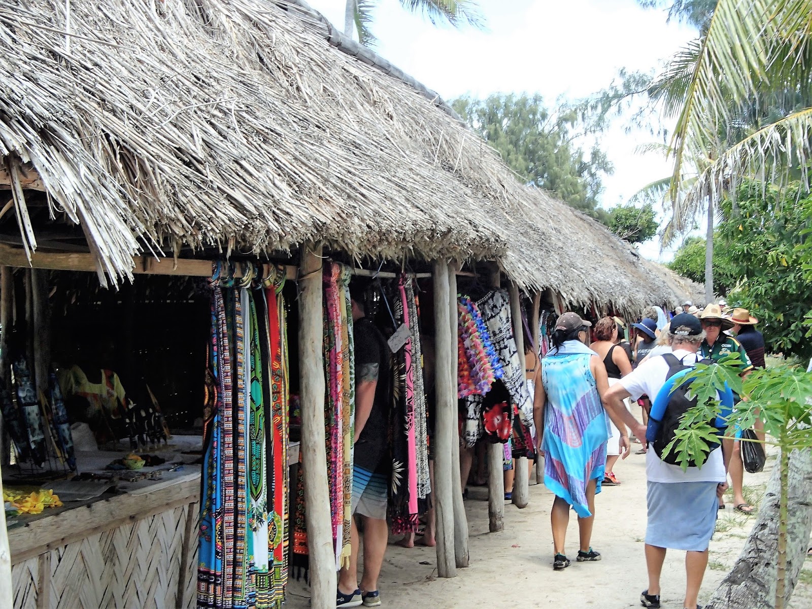
Signs advertise eats/drinks/clothing/touristy trinkets/swimming-snorkelling gear for hire/snorkeling and other trips/ plus of course the ubiquitous and very popular hair plaiting.
New in Feb 2018 - a big sqare of shopping stalls offering the usual clothing/artifacts/massages/hair braiding yada. This area now has more choice than the big pier-side markets at PORT VILA.
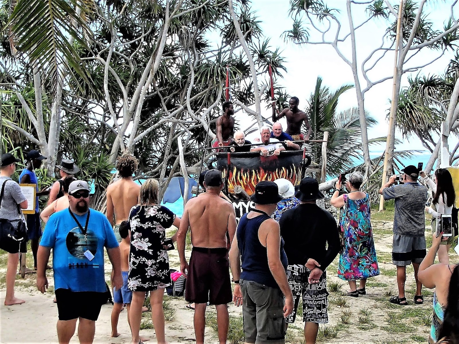
Not new but always popular - the ol' canibal pot/snap pix fer $5. Guesse if I paid fer this shot.
Waiting to be tendered back to the Legend (tender transfers are free). Mystery Island seems a good anchorage - the island's reef gives protection from the SE swell so that transfers are relatively stable - in 4 visits we have got off the ship each time, unlike nearby Isle of Pines (2 in 4)
LATEST VISIT UPDATE
Things were much the same in JAN 2019 apart from being hotter on the lee side of the island on account of being the first high summer visit). However the far side had a delightful sea breeze (um, actually the SE TRADES which are the prevailing winds here more often than not) which made it the area to go. Plenty of tree shade in back of beach.
One new to me feature (I didn't venture here in DEC 2018) was an area on the windward beach with several operators offering beach cabanas. Apparently rental includes drinks and snacks. Seemed very popular. (image TRIPADVISOR)
ACCESSING MYSTERY ISLAND.
Nearly all visitors are cruise ship passengers. It would be possible to fly in from PORT VILA or NOUMEA but with so many other closer options why would people do this? Ditto cruising yachts - MYSTERY ISLAND is nice but VANUATU, THE SOLOMAN ISLANDS and NEW CALEDONIA'S LOYALTY ISLANDS have hundreds of gorgeous beaches with good anchorages for small craft.
WARNING UPDATE - since our return from the latest JAN 2019 CRUISE social media has reported one case of VANUATU CUSTOMS AUTHORITIES inspecting visitors' bags at the pier and fining them for any food brought from the ship. This is always warned about prior to disembarkation but I have to say that in maybe a hundred SW PACIFIC shore-side visits over the years it has never happened to me.
However the fine of $aud150 (added to your onboard account) is a great deterrent.
IF YOU SEE MISTAKES OR HAVE ADDITIONAL INFORMATION, PLEASE POST BELOW.
BUT IF YOU HAVE QUESTIONS PLEASE ASK THEM IN THE FORUM SECTION WHICH I CHECK MOST DAYS WHEN NOT TRAVELLING - WHEREAS I SELDOM REVISIT THESE INDIVIDUAL DESTINATION PAGES.
-------------------------------------------------